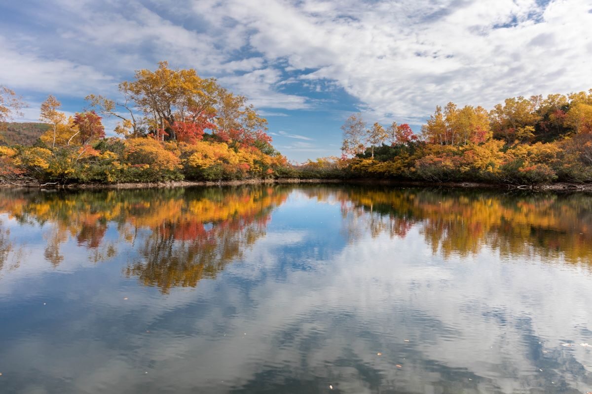
Hokkaido is the northernmost island in Japan representing 22% of Japan’s total land mass and only 5% of its population. It consists of one large island and 5 smaller islands.
There are six national parks, five quasi-national parks, and twelve prefectural parks. Hokkaido is blessed with arguably the most magnificent natural beauty in Japan. Furthermore, the relatively cooler climate makes it an ideal getaway during Japan’s sweltering summer. There are four distinct seasons and no rainy season.

Hokkaido is the northernmost island in Japan representing 22% of Japan’s total land mass and only 5% of its population. It consists of one large island and 5 smaller islands. There are six national parks, five quasi-national parks, and twelve prefectural parks.
Hokkaido is blessed with arguably the most magnificent natural beauty in Japan. Furthermore, the relatively cooler climate makes it an ideal getaway during Japan’s sweltering summer. There are four distinct seasons and no rainy season.
Sapporo Area
Mt. Moiwa
Mt. Moiwa rises 531 meters above downtown Sapporo. From the summit, there is a panoramic view of the city and the Ishikari Plain. On a clear day, you can see as far as the Daisetsuzan Mountains. Recreation includes hiking in the summer and skiing in the winter. You can take a ropeway to the top in eight minutes.
Access to Mt. Moiwa: 7 min walk from Ropeway Iriguchi Streetcar Station.
Lake Kuttara
Only 7 kilometers from Noboribetsu Onsen, this is the second clearest lake in Hokkaido. The water is very cold, but you can rent rowboats to explore the lake and surrounding shores. Regular bus services run from Noboribetsu during the summer months.
Other
At Lake Shikotsu camping is available. Mt. Teine and Mt. Moiwa offer scenic hiking trails as well as campsites and auto campsites.
Shikotsu-Toya National Park Area
This park consists of Toya, Shotsu, Noboribetsu, and Jozankei hot springs. There are various volcanoes, caldera lakes and hot springs to visit. It is the closest National Park to Sapporo, making it one of the most popular tourist destinations in Hokkaido.
Lake Shikotsu
This caldera lake is the northernmost ice-free lake in Japan. It is surrounded by mountains and is a popular fishing area. Camping is available.
Access to Lake Shikotsu: 1hr 20 min by Chuo bus from Sapporo Station Bus Terminal to Shikotsu Kohan bus stop.
Lake Toya
This lake is surrounded by hot springs and is a popular resort area throughout the year. Many deer and other animals can be seen on the large island in the center of the lake. Cheap camping is available, and you can rent a tent if you don’t have one yourself.
Mt. Yotei
This volcanic mountain is referred to as “Ezo Fuji” because its conical shape resembles its famous friend. From the top of Mt. Yotei, both the Sea of Japan and the Pacific Ocean can be seen. The mountain can be climbed within seven hours, and it’s also a good mountain biking area.
Access to Mt. Yotei: 10 min. by Donan bus from (Toyako Onsen Eki) from JR Kutchan Station to Yotei Tozanguchi bus stop.
Daisetsuzan National Park Area

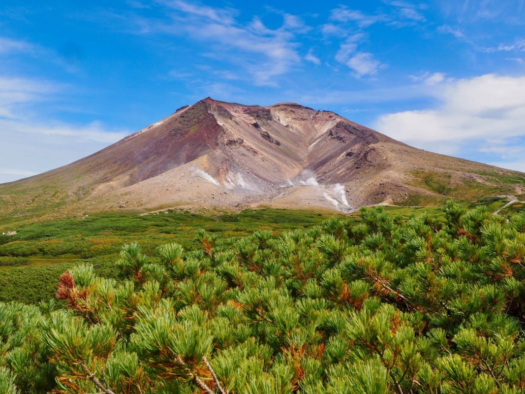
Daisetsuzan is Japan’s largest national park, and arguably the most beautiful as well. The park bursts with mountains, rivers, gorges, forests, flowers, waterfalls, animals, and hiking trails. It also contains three volcanic mountain areas, including the highest in Hokkaido, Mt. Asahi.
The best place to explore the area is Sounkyo Onsen, situated near Daisetsuzan’s most popular attraction, Sounkyo Gorge. The town isn’t anything spectacular, but it makes a great base for planning a hike or bike trip into the gorge.
Read More: Daisetsuzan National Park
Daisetsuzan Mountain Range

This range has many sheer cliffs and small, yet attractive hot springs near the base of the mountains. Mt. Asahidake is one of them. The long magnificent valley features many beautiful waterfalls and large plateaus with various alpine plants.
Access To Asahidake: 1hr 35 min by Asahikawa Denki Kido Bus from JR Asahikawa Station to Asahidake bus stop.
Sounkyo Onsen
This is the largest hot spring area in Daisetsuzan and a popular base for hikers and climbers. Rows of modern hotels and inns line the sparkling Ishikari River in this area.
Mt. Kurodake and Mt. Asahi

Take a ropeway to the fifth station of Mt. Kurodake, 1300 meters above sea level, and you will get a magnificent view of the Daisetsuzan mountain range. The ropeway only takes about 7 minutes to the top, from where you can hike around the area or take a 15-minute chairlift even further up the mountain. From here you can reach the summit in about an hour or choose from several different hikes along the mountain ridges.

If you are interested in a longer hike, you can walk from the Sounkyo chairlift over Mt. Asahi and on to Asahidake Onsen. The trip takes about 8 to 10 hours depending on your pace. The only trail guides are in Japanese, but so are the trail signs, so it wouldn’t do you much good to have an English map anyway. Skiing and snowboarding can be enjoyed in this area until mid-may.
Access to Mt. Kurodake and Mt. Asahi: 30 minutes by Dohoku bus from JR Kamikawa Station to Sounkyo bus stop then take the ropeway to the seventh stage of the mountain and it’s a 1-hour walk to the top.
Teninkyo Gorge and Teninkyo Onsen
In the center of this gorge lies the peaceful Teninkyo hot springs, surrounded by forest, large, steep cliffs and various waterfalls.
Access to Teninkyo: 1hr 5 min by Asahikawa Denki Kido bus from JR Asahikawa Station to Teninkyo bus stop.
Tomamu Resort
Many large-scale resorts are being developed on this 1239-meter mountain, with several large hotel facilities golf courses, swimming pools, tennis courts, a wildlife sanctuary and trails for exploring the natural beauty of the surrounding forests.
Access to Tomamu Resort : 15 minutes from JR Shimukappu Station to JR Tomamu Station.
Kamui Kotan
The Ishikari River flowing to the west of Asahikawa created this beautiful valley. Kamui Kotan is an Ainu word meaning “a place where God lives.”
Akan National Park Area
Akan National Park is a volcanic area with craters spread throughout the forest. It also contains three crystal clear lakes. The best place to stay is Akanko Onsen, a small hot spring resort on the edge of lake Akan. It also makes a good base from which to explore both the Akan National Park and the nearby Red-Crested Crane National Park.
Read More: Akan National Park Area Guide
Lake Akan

From the lake, you’ll see two cone-shaped volcanoes, Mt. Oakan (Oakandake) to the east and Mt. Meakan (Meakandake) to the south. Both are great for hiking. Mt. Oakan isn’t active and it’s about a 4-½ hour hike to the summit from Akanko Onsen.
The trail starts at Takiguchi. Mt. Meakan is the highest mountain in the area and is an active volcano. There are three trails up the mountain, one of which takes about 6 hours to reach the top.
You can pick up good hiking guides in English at the tourist association. There is a shorter hike to Mt. Hakutozan, from where you can get a great view of the lake below. It takes about 20 minutes to reach Akan’s skiing area and another 30 minutes to get to Mt. Hakutozan.
You can get directions to the trailhead at the local tourist office as well.
Lake Kushiro
This is the largest lake in Akan National Park. Kawayu hot spring pours into the lake as well. This onsen area, surrounded by fir trees, features Mt. Iou. Mt. Iou is a 510-meter active volcano situated to the south of Kawayu Onsen. From the middle of June, the foot of this mountain is filled with white Ezo labrador tea flowers. Access to Lake Kusharo is 35 minutes by Akan bus from Teshikaga Onsen bus stop to Wakoto Hanto bus stop.


